Research - 04.08.2026 - 09:45
Up-to-date and unbiased data on economic, social and environmental issues can be difficult to obtain. A team of researchers at the Institute of Responsible Innovation, Sustainability and Energy of the University of St.Gallen (RISE-HSG) has therefore been harnessing satellite data to close knowledge gaps in entrepreneurship research.
With the help of satellite data, Prof. Dr. Charlotta Sirén, Associate Professor at RISE-HSG, and her team have developed insights into issues that are often hard to investigate, because they confront vested interests or because logistical difficulties prevent the timely availability of data. While their previous projects examined the effects of the Covid crisis on economic activity in China as well as the unintended consequences of palm oil certificates, their most recent research explores the impact of governmental interventions on informal entrepreneurship in Indian slums.
Accessing reliable data for investigations on such potentially contentious topics can be a great challenge: “With all of these projects, we are tapping into sensitive issues in the sense that either data do not exist or companies are not willing to reveal data”, Sirén notes. For example, why would a palm oil company investing into becoming compliant with sustainability certificates provide data that may contradict the labels’ intended impact? But the problem is not limited to businesses: “Even with government statistics, they are not always reliable because the incentives to not report reliable numbers are quite high. For example, India is not reporting how many slums they have. Or we know from China that they needed to revise some of their GDP measures because they inflated the numbers some years ago”, she explains.
Logistics, time and space are other challenges where satellite data can bring real advantages. While it can take years to collect and compile data on demographic, economic or social developments in a country, satellite data can be made available on a near-daily basis. Sirén illustrates the problem: “For government statistics, you might get them once a year or once in five years. But the world is living now. With satellite data, you can capture what happens almost daily or weekly.” In addition, data collection with conventional methods over large geographical areas is prone to errors due to the complex logistics involved. Dr. Michael Hudecheck, a postdoctoral researcher at RISE-HSG, explains: “One of the problems that the Indian federal government has is the fact that the information they have is reported by the individual states. And of course, there's always an open question about what is actually happening on the ground and whether or not the data is actually accurate”.
Non-commercial satellite data is also inexpensive. It is freely available through public organisations like the European Space Agency and increasingly provided in ready-to-use formats: While data previously required intensive pre-processing from researchers themselves, agencies now clean and organise most of the data in-house before releasing it to the public. This makes the use of satellite data for research even more accessible. “Because the satellite system is a multi-billion investment from the governments, to make that system more useful, the data is made much more readily available and better usable for researchers. So I would say the bar now to start a new project using this method is much lower than it was seven years ago”, Sirén says.
The accessibility of data is particularly important from an ethical perspective when studying more vulnerable populations. Dr. Nina Zachlod, who completed her PhD under the supervision of Prof. Sirén in 2025 and is now a postdoctoral researcher at the University of Geneva, explains that this was a central consideration in the project on informal entrepreneurship in Indian slums: “From a place like Switzerland, looking into these contexts, it's important that we use data that is equally accessible in the parts of the world that we investigate as it is for us here.”
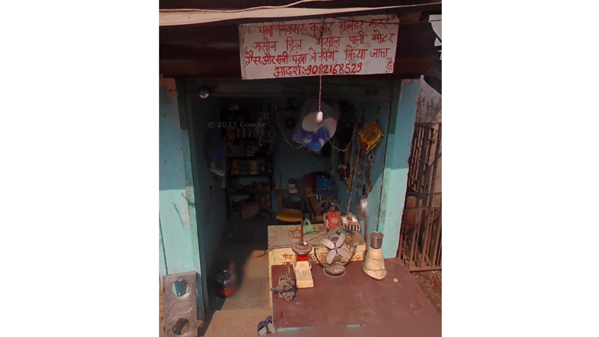
Nevertheless, other information sources are necessary because certain issues cannot be appropriately measured through visual data alone. The research on informal entrepreneurship exemplifies this. A central distinction in the project is that between formal and informal entrepreneurship – a categorisation which cannot easily be done through visual cues. The solution to this problem lies in combining satellite data with geospatial data. Sirén explains: “Can we track entrepreneurs? No, we can’t. But we can track the infrastructure. And we use other data sources, for example from Google, to track where street vendors are and other infrastructural changes to understand how the slum has developed over time.”
Surveys can also be valuable as an addition, as Zachlod illustrates: “The geospatial data on the businesses tells us the business type, but it doesn't tell us if the business is registered with the government. However, we have survey data on formality and informality from the World Bank Enterprise Surveys. Based on that, we were able to derive proxies”. Using these proxy measures, the team was able to classify individual businesses as more likely to be formal or informal.
With the project on informal entrepreneurship in Indian slums, the team and their partners from Jawaharlal Nehru University in New Delhi und North-Eastern Hill University in Shillong, India, aim to develop best practices for governing informal entrepreneurship. Governments act in a wealth creation paradox: Informal entrepreneurs contribute substantially to India’s economic activity, development and GDP. But they do not pay taxes. Governments may therefore seek to formalise or prevent their activity. Yet this, in turn, may reduce these businesses’ ability to thrive. “From a societal perspective, it really boils down to: Is there a point in making sure that every informal entrepreneur becomes formalised, especially in these slum areas, these very vulnerable and marginalised communities?”, Zachlod explains. “Do we want to prevent all the positive things that come from informal entrepreneurship, for the entrepreneurs, their families, the communities that they operate in? Or do we see it as something for which the primary goal is to make it flourish and see it as a driver of development, of poverty alleviation for those communities?”
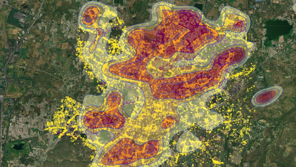
What is the role of spatial factors and satellite data? Many governmental interventions in slum areas have spatial implications: Changes in architectural features and the provision of infrastructure are visible transformations. “For example, what happens when the government tears down the double purpose rooms where informal entrepreneurs can set up their stores and instead replace them with a high-rise building? These buildings might have running water, sanitation and electricity, but this can also deprive these entrepreneurs of their only source of income”, Zachlod says. In addition, the establishment of formal institutions in proximity could affect informal entrepreneurship: “For example, if a police station is deployed to an area, this is going to affect the entrepreneurs in that area. The proximity makes a difference”. The team considered control institutions like police stations and government offices, but also supportive institutions– like hospitals or schools – that they assumed would support development of informal entrepreneurship. This is where satellite data comes into play: They are used for spatial and distance mapping to examine the spatial influence of these institutions on informal activity.
What did the project reveal? The team found that informal entrepreneurship is concentrated in areas that are furthest from institutional presence – independently of the type of the institution. Put simply: The farther a business is located from institutions such as police stations, courts, schools, and hospitals, the more likely there was to be some form of informal entrepreneurship. “It's not that one type of institution is good, and the other is bad. Instead, we see a general trajectory of distance regardless of the type of institution”, Zachlod explains.
Going forward, the team aims to work together with local authorities and decision-makers to develop tailored interventions. “Our main goal is to make sure that policy makers both understand the role of informal entrepreneurship, but they also understand how it relates to the deployment of formal institutions. Ultimately, we hope to derive more targeted policy interventions that are supportive both of the development of the informal entrepreneurs, but also economic development”, concludes Zachlod.